
Image: RabaulStrategicArea

Size of this preview: 800 × 463 pixels. Other resolutions: 320 × 185 pixels | 2,500 × 1,448 pixels.
Original image (2,500 × 1,448 pixels, file size: 535 KB, MIME type: image/jpeg)
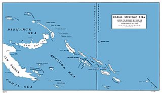
Description: U.S. Marine map of SouthWest Pacific area, 1942
Title: RabaulStrategicArea
Credit: [1] [2] Melson, Charles D. (1993). UP THE SLOT: Marines in the Central Solomons. WORLD WAR II COMMEMORATIVE SERIES 36. History and Museums Division, Headquarters, U.S. Marine Corps. Retrieved on Sept 26.
Author: Charles D. Melson; Cartographic and visual information: George C. MacGillivray and W. Stephen Hill
Usage Terms: Public domain
License: Public domain
Attribution Required?: No
Image usage
The following page links to this image:

All content from Kiddle encyclopedia articles (including the article images and facts) can be freely used under Attribution-ShareAlike license, unless stated otherwise.