
Image: Rail map scotland 2014

Size of this preview: 363 × 600 pixels. Other resolutions: 145 × 240 pixels | 1,349 × 2,229 pixels.
Original image (1,349 × 2,229 pixels, file size: 436 KB, MIME type: image/png)
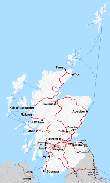
Description: Map of the rail routes of Scotland in 2014. Borders railway is shown under construction, due to open September 2015.
Title: Rail map scotland 2014
Credit: Own work
Author: Cnbrb
Usage Terms: Creative Commons Attribution-Share Alike 2.0
License: CC BY-SA 2.0
License Link: http://creativecommons.org/licenses/by-sa/2.0
Attribution Required?: Yes
Image usage
The following 2 pages link to this image:

All content from Kiddle encyclopedia articles (including the article images and facts) can be freely used under Attribution-ShareAlike license, unless stated otherwise.