
Image: Red River Floodway from the air

Size of this preview: 800 × 600 pixels. Other resolutions: 320 × 240 pixels | 2,592 × 1,944 pixels.
Original image (2,592 × 1,944 pixels, file size: 683 KB, MIME type: image/jpeg)
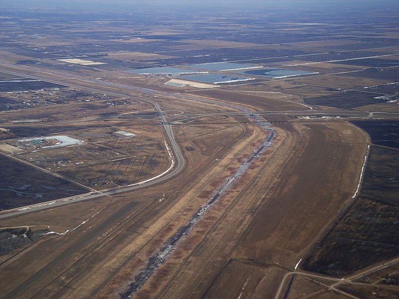
Description: Red River floodway at the southeast corner of the Winnipeg city limits near Lorette as seen from the air. The Trans Canada Highway and Canadian National Railway bridges over the floodway can be seen, along with the Perimeter Highway.
Title: Red River Floodway from the air
Credit: Own work (Original text: I (JPark99 (talk)) created this work entirely by myself.)
Author: JPark99 (talk)
Usage Terms: Public domain
License: Public domain
Attribution Required?: No
Image usage
The following 4 pages link to this image:

All content from Kiddle encyclopedia articles (including the article images and facts) can be freely used under Attribution-ShareAlike license, unless stated otherwise.