
Image: Red Sea Gulf of Aden 1519

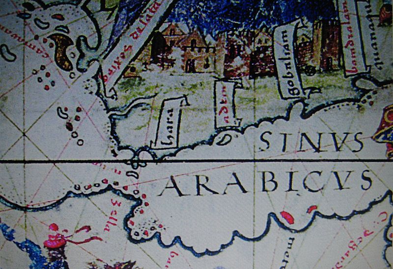
Description: Enlarged view of a section of one of the panels of the 1519 Lopo Homem-Reineis Atlas (the Miller Atlas) showing the Gulf of Aden and the south of the Red Sea. The island of Perim ("Majun" on the map, from the Arabic Mayyun) is clearly shown at the junction of the Gulf and the Sea. To the north of Perim one can see the larger island of Kamaran ("Camaran"), that Albuquerque's fleet used as a base for some time after penetrating the Red Sea following its failure to capture Aden in 1513. Aden, a peninsula, is shown as an island, as on many later maps and engravings.
Title: Red Sea Gulf of Aden 1519
Credit: Many Internet sources including https://www.saudiaramcoworld.com/issue/200504/the.coming.of.the.portuguese.htm
Author: The Miller Atlas (Lopo Homem-Reineis Atlas), 1519 (my cropping of a much larger map).
Usage Terms: Public domain
License: Public domain
Attribution Required?: No
Image usage
The following page links to this image:
