
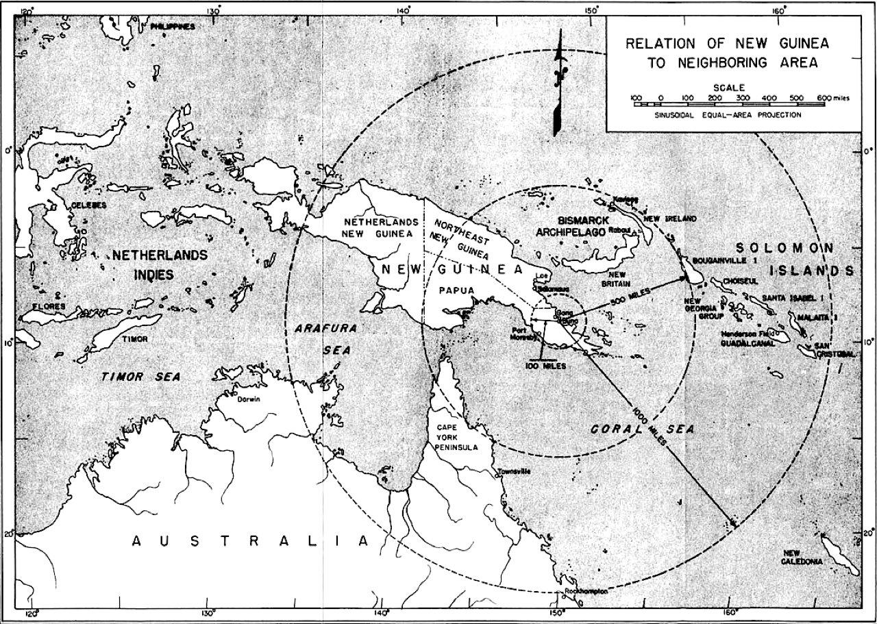
Image: Relation of Buna-Sanananda-New Guinea to Neighboring Area
Size of this preview: 800 × 569 pixels. Other resolutions: 320 × 228 pixels | 1,280 × 911 pixels.
Original image (1,280 × 911 pixels, file size: 730 KB, MIME type: image/png)
Description: Relation of New Guinea to Neighboring Area, from PAPUAN CAMPAIGN The Buna-Sanananda Operation 16 November 1942 - 23 January 1943—Map 1
Title: Relation of Buna-Sanananda-New Guinea to Neighboring Area
Credit: http://www.history.army.mil/books/wwii/papuancamp/map1.jpg
Author: Historical Division, War Department, for the American Forces in Action series (United States Army Center of Military History)
Usage Terms: Public domain
License: Public domain
Attribution Required?: No
Image usage
The following page links to this image:

All content from Kiddle encyclopedia articles (including the article images and facts) can be freely used under Attribution-ShareAlike license, unless stated otherwise.