
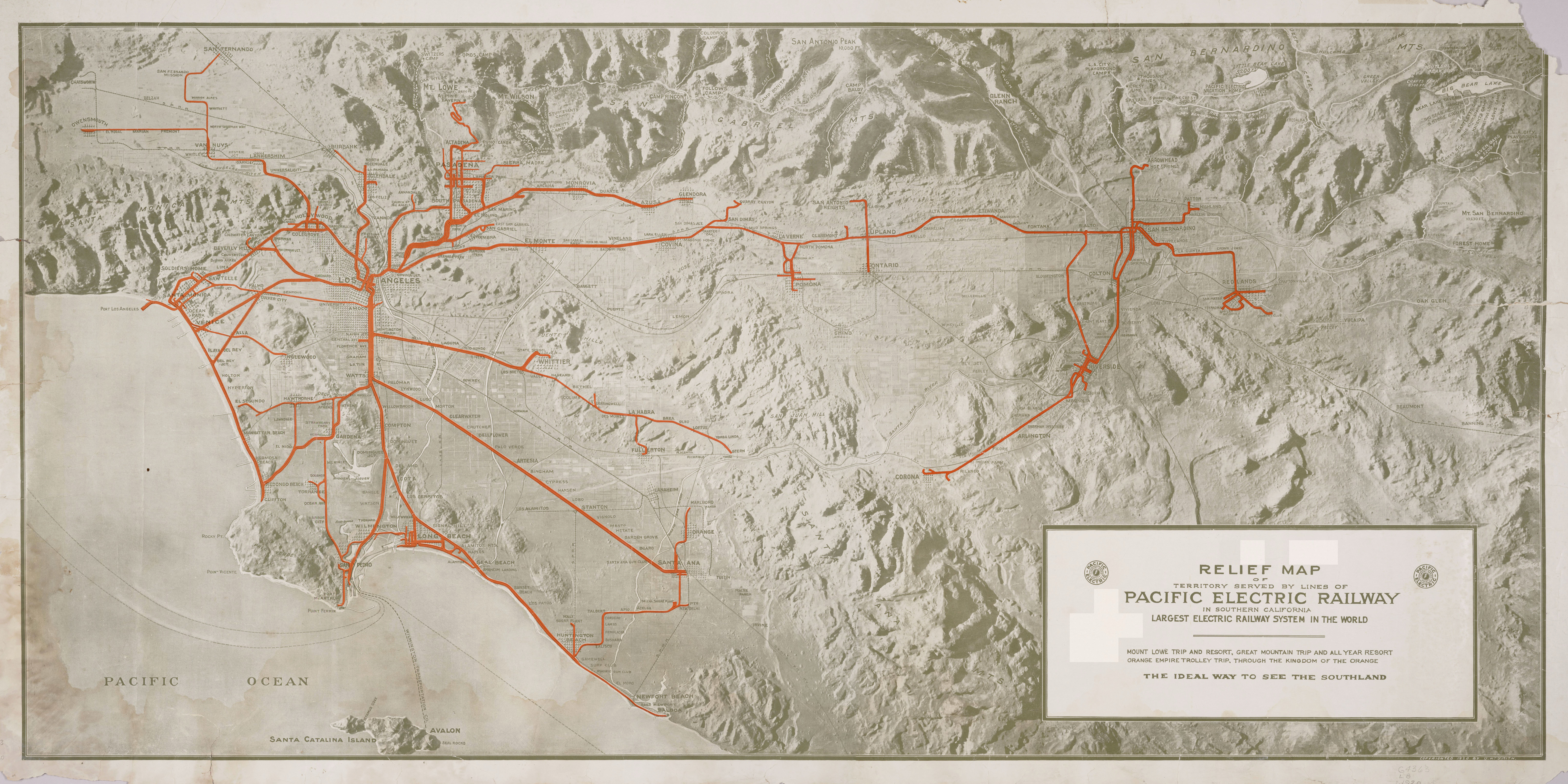
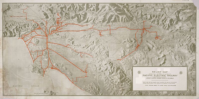
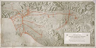
Image: Relief map Pacific Electric Railway
Size of this preview: 800 × 400 pixels. Other resolutions: 320 × 160 pixels | 6,432 × 3,216 pixels.
Original image (6,432 × 3,216 pixels, file size: 9.25 MB, MIME type: image/jpeg)
Description: Relief map of territory served by lines of [the] Pacific Electric Railway in Southern California; largest electric railway system in the world Copyrighted 1920 by O.A. Smith Railway lines are overprinted in red Includes Santa Catalina Island "Mount Lowe trip and resort, great mountain trip and all year resort; Orange Empire trolley trip through the Kingdom of Orange"
Title: Relief map Pacific Electric Railway
Credit: http://content.cdlib.org/ark:/13030/hb638nb72q/?layout=metadata
Author: Smith, O. A, Cartographer
Usage Terms: Public domain
License: Public domain
Attribution Required?: No
Image usage
The following 2 pages link to this image:

All content from Kiddle encyclopedia articles (including the article images and facts) can be freely used under Attribution-ShareAlike license, unless stated otherwise.