
Image: Relief map USA Connecticut

Size of this preview: 707 × 599 pixels. Other resolutions: 283 × 240 pixels | 800 × 678 pixels.
Original image (800 × 678 pixels, file size: 690 KB, MIME type: image/png)
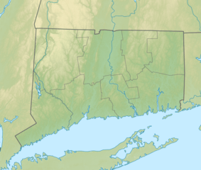
Description: Relief map of Connecticut, USA.
Title: Relief map USA Connecticut
Credit: SRTM3 for relief File:USA Connecticut location map.svg for borders, rivers and coastline; by Alexrk2 Own work using [[File:|32x20px]] This map was created with GMT. This PNG graphic was created with Inkscape.
Author: Nzeemin
Usage Terms: Creative Commons Attribution-Share Alike 3.0
License: CC BY-SA 3.0
License Link: https://creativecommons.org/licenses/by-sa/3.0
Attribution Required?: Yes
Image usage
The following 66 pages link to this image:
- Ashford Lake
- Aspetuck Reservoir
- Avery Point Light
- Bantam Lake
- Barn Door Hills
- Basset Brook
- Beacon Hill (Branford, Connecticut)
- Besek Mountain
- Bigelow Brook
- Bradley Mountain
- Breakneck Pond
- Burley Hill (Connecticut)
- Candlewood Lake
- Cathole Mountain
- Converse Lake
- Danbury, Connecticut
- Deer Lake (Connecticut)
- Derby, Connecticut
- Falkner Island Light
- Five Mile Point Light
- Fowler Mountain
- Gardner Lake
- Great Captain Island Light
- Great Hollow Lake
- Greens Ledge Light
- Gridley Mountain
- Higganum Reservoir
- Highland Lake (Winchester, Connecticut)
- Hop Brook Lake
- Lake Beseck
- Lake Chaffee
- Lake Gaillard
- Lake Hayward (Connecticut)
- Lake Lillinonah
- Lake Quassapaug
- Lake Saltonstall (Connecticut)
- Lake Waramaug
- Lake Whitney (Connecticut)
- Lake Wononscopomuc
- Lake Zoar
- Lynde Point Light
- Manitook Mountain
- Manresa Island
- Mansfield Hollow Lake
- Mashapaug Lake
- Mohegan Sun Arena
- Morgan Point Light
- Mount Hope River
- Natchaug River
- New Haven, Connecticut
- New London Harbor Light
- New London Ledge Light
- Penfield Reef Light
- Pinewood Lake
- Quaddick Reservoir
- Round Pond (Connecticut)
- Saugatuck Reservoir
- Saville Dam
- Shenipsit Lake
- Sleeping Giant (Connecticut)
- Southwest Ledge Light
- Stonington Harbor Light
- Success Lake (Connecticut)
- Tuxis Pond
- West Thompson Lake
- Wetherell Pond

All content from Kiddle encyclopedia articles (including the article images and facts) can be freely used under Attribution-ShareAlike license, unless stated otherwise.