
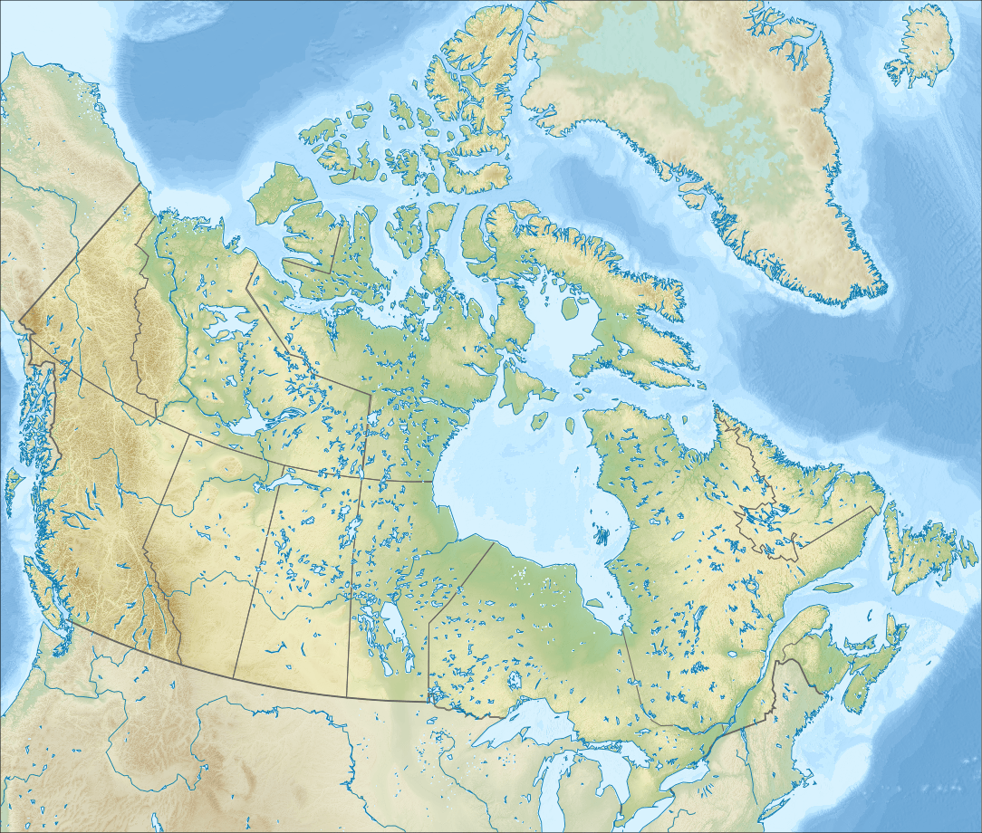
Image: Relief map of Canada
Description: Relief map of Canada. Projection: Lambert Conformal Conic Projection lon0 = -27° lat0 = 69° lat1 = 51° lat2 = 45° Projection/coords for GMT: -Jl-95/49/49/77/1:29350000 -R-121.36/38.29/-11.5/63.0r
Title: Relief map of Canada
Credit: ETOPO1 for relief and bathymetry GSHHS dataset for coastline and rivers File:Canada location map.svg for borders; by Yug and STyx Own work Created with Generic Mapping Tools (GMT) This vector image was created with Inkscape.
Author: Nzeemin
Usage Terms: Creative Commons Attribution-Share Alike 3.0
License: CC BY-SA 3.0
License Link: http://creativecommons.org/licenses/by-sa/3.0
Attribution Required?: Yes
Image usage
More than 100 pages link to this image. The following list shows the first 100 page links to this image only. A full list is available.
- Abee
- Aetna, Alberta
- Alcomdale
- Alder Flats
- Altario
- Ardenode, Alberta
- Ardley, Alberta
- Beauvallon, Alberta
- Beaver Crossing, Alberta
- Beaverdam, Alberta
- Beazer, Alberta
- Bellis, Alberta
- Benchlands
- Bindloss
- Bircham, Alberta
- Blackfoot, Alberta
- Blackie, Alberta
- Bluffton, Alberta
- Bodo, Alberta
- Bone Town, Alberta
- Bottrel
- Bow City, Alberta (hamlet)
- Brant, Alberta
- Bristol Oakes, Alberta
- Brosseau, Alberta
- Brownfield, Alberta
- Brownvale
- Buck Creek, Alberta
- Buford, Alberta
- Cadogan, Alberta
- Cadotte Lake
- Campsie, Alberta
- Canyon Creek, Alberta
- Canyon Heights, Alberta
- Carbondale, Alberta
- Cardiff, Alberta
- Carseland
- Carway, Alberta
- Cassils, Alberta
- Chancellor, Alberta
- Charlottetown
- Chin, Alberta
- Chinook, Alberta
- Clandonald
- Clearwater Estates, Alberta
- Cochrane Lake, Alberta
- Compeer, Alberta
- Conrich
- Craigmyle, Alberta
- Crystal Meadows, Alberta
- Cynthia, Alberta
- Dalroy
- Dapp
- Dawn Valley, Alberta
- Dead Man's Flats
- Deadwood, Alberta
- Delacour, Alberta
- Demmitt
- Desert Blume
- Devonshire Meadows, Alberta
- Diamond City, Alberta
- Dickson, Alberta
- Dimsdale, Alberta
- Duffield, Alberta
- Duhamel, Alberta
- Duvernay, Alberta
- Eaglesham, Alberta
- Eastview Acres, Alberta
- Edmonton
- Edwand
- Egremont, Alberta
- Enilda
- Ensign, Alberta
- Erin Estates, Alberta
- Erskine, Alberta
- Fabyan, Alberta
- Fairview, Alberta (hamlet)
- Falun, Alberta
- Faust, Alberta
- Fawcett, Alberta
- Ferrier, Alberta
- Flatbush, Alberta
- Fleet, Alberta
- Fort Kent, Alberta
- Fort Vermilion
- Fredericton
- Garden Grove Estates, Alberta
- Gem, Alberta
- Gleichen, Alberta
- Glenevis
- Glory Hills, Alberta
- Goodfare
- Grandmuir Estates, Alberta
- Green Acre Estates, Alberta
- Green Court
- Greenshields, Alberta
- Gregoire Lake Estates
- Grouard
- Rogers Centre
- Southampton Island
