
Image: Reliefkarte Solothurn blank

Size of this preview: 726 × 600 pixels. Other resolutions: 291 × 240 pixels | 1,734 × 1,433 pixels.
Original image (1,734 × 1,433 pixels, file size: 2.41 MB, MIME type: image/png)
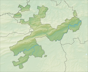
Description: Reliefkarte des Kantons Solothurn
Title: Reliefkarte Solothurn blank
Credit: Own work
Author: Tschubby
Permission: You may select the license of your choice.
Usage Terms: Creative Commons Attribution-Share Alike 3.0
License: CC-BY-SA-3.0
License Link: http://creativecommons.org/licenses/by-sa/3.0/
Attribution Required?: Yes
Image usage
The following 43 pages link to this image:
- Aetigkofen
- Bettlach, Switzerland
- Bibern, Solothurn
- Biezwil
- Gossliwil
- Grenchen
- Grindel, Switzerland
- Hauenstein-Ifenthal
- Heinrichswil-Winistorf
- Hessigkofen
- Himmelried
- Holderbank, Solothurn
- Horriwil
- Härkingen
- Hüniken
- Kammersrohr
- Kestenholz
- Kleinlützel
- Kyburg-Buchegg
- Langendorf, Switzerland
- Lommiswil
- Lüterkofen-Ichertswil
- Lüterswil-Gächliwil
- Nuglar-St. Pantaleon
- Oberramsern
- Schnottwil
- Seewen
- Selzach
- Solothurn (city)
- Starrkirch-Wil
- Steinhof
- Stüsslingen
- Subingen
- Trimbach, Switzerland
- Tscheppach
- Unterramsern
- Walterswil, Solothurn
- Wangen bei Olten
- Welschenrohr
- Winznau
- Witterswil
- Zuchwil
- Zullwil

All content from Kiddle encyclopedia articles (including the article images and facts) can be freely used under Attribution-ShareAlike license, unless stated otherwise.