
Image: Richfield hist boundaries
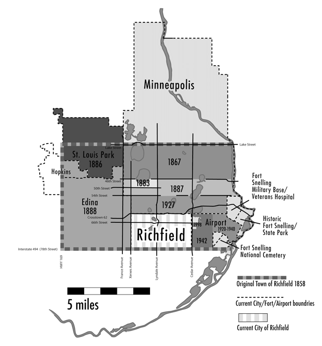
Description: Map shows the partitioning of the town of Richfield starting in 1854 to the present day city of Richfield. Map illustration by Joe Hoover, 2007, for book: "Richfield: Minnesota's Oldest Suburb" published by the Richfield Historical Society. Reproduced with permission of the artist and released to public domain courtesy of Joe Hoover. Sources Johnson, Fred, Richfield, Minnesota's Oldest Suburb 14, (Richfield: Richfield Historical Society Press). David J. Butler. "Did the Town of Richfield ever extend as far north as Franklin Avenue?" Richfield Historical Society Bulletin, (Summer 2006):3-4. Balcom, Early Richfield History
Title: Richfield hist boundaries
Credit: Own work
Author: Joe Hoover (Myotus at English Wikipedia)
Usage Terms: Public domain
License: Public domain
Attribution Required?: No
Image usage
The following page links to this image:
