
Image: Riogranderivermap

Size of this preview: 508 × 600 pixels. Other resolutions: 203 × 240 pixels | 1,000 × 1,181 pixels.
Original image (1,000 × 1,181 pixels, file size: 1.95 MB, MIME type: image/png)
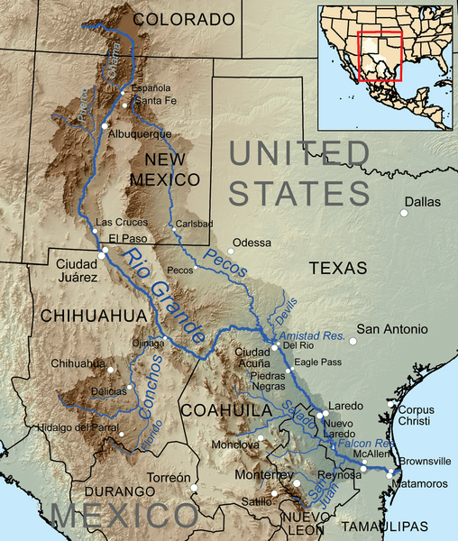
Description: Map showing the Rio Grande, and its tributaries — within the Rio Grande drainage basin Located in northeastern Mexico and the southwestern / south-central United States.
Title: Riogranderivermap
Credit: Own work, Elevation data from SRTM, drainage basin from GTOPO [1], U.S. stream from the National Atlas [2], all other features from Vector Map.
Author: Kmusser
Usage Terms: Creative Commons Attribution-Share Alike 3.0
License: CC BY-SA 3.0
License Link: http://creativecommons.org/licenses/by-sa/3.0
Attribution Required?: Yes
Image usage

All content from Kiddle encyclopedia articles (including the article images and facts) can be freely used under Attribution-ShareAlike license, unless stated otherwise.