
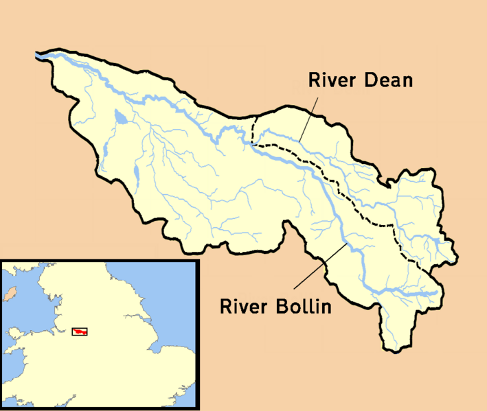
Image: River Bollin catchment area

Size of this preview: 709 × 599 pixels. Other resolutions: 284 × 240 pixels | 957 × 809 pixels.
Original image (957 × 809 pixels, file size: 97 KB, MIME type: image/png)
Description: A map showing the catchment area/drainage basin of the River Bollin in Cheshire, UK.
Title: River Bollin catchment area
Credit: self-made - based on data from the New Popular Edition series Ordnance Survey maps. Maps used published 1948 and 1949, now out of copyright since more than 50 years have elapsed since publication.
Author: RichardB
Usage Terms: Public domain
License: Public domain
Attribution Required?: No
Image usage
The following page links to this image:

All content from Kiddle encyclopedia articles (including the article images and facts) can be freely used under Attribution-ShareAlike license, unless stated otherwise.