
Image: River Wey Map 2

Size of this preview: 597 × 600 pixels. Other resolutions: 239 × 240 pixels | 644 × 647 pixels.
Original image (644 × 647 pixels, file size: 85 KB, MIME type: image/png)
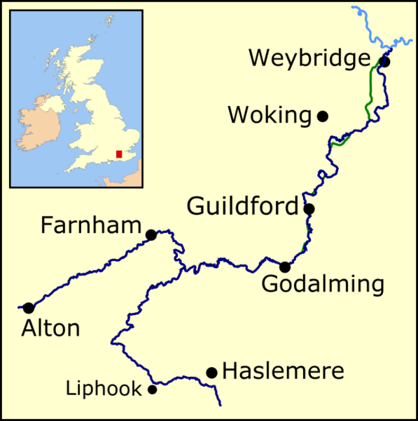
Description: Map of the River Wey (dark blue), showing both the North and South branches. Part of the River Thames is shown in light blue. Canal sections of the Wey and Godalming Navigations are shown in green.
Usage Terms: Public domain
Image usage
The following page links to this image:

All content from Kiddle encyclopedia articles (including the article images and facts) can be freely used under Attribution-ShareAlike license, unless stated otherwise.