
Image: Rogers Dry Lake (California) – satellite image
Size of this preview: 800 × 547 pixels. Other resolutions: 320 × 219 pixels | 2,802 × 1,917 pixels.
Original image (2,802 × 1,917 pixels, file size: 2 MB, MIME type: image/jpeg)
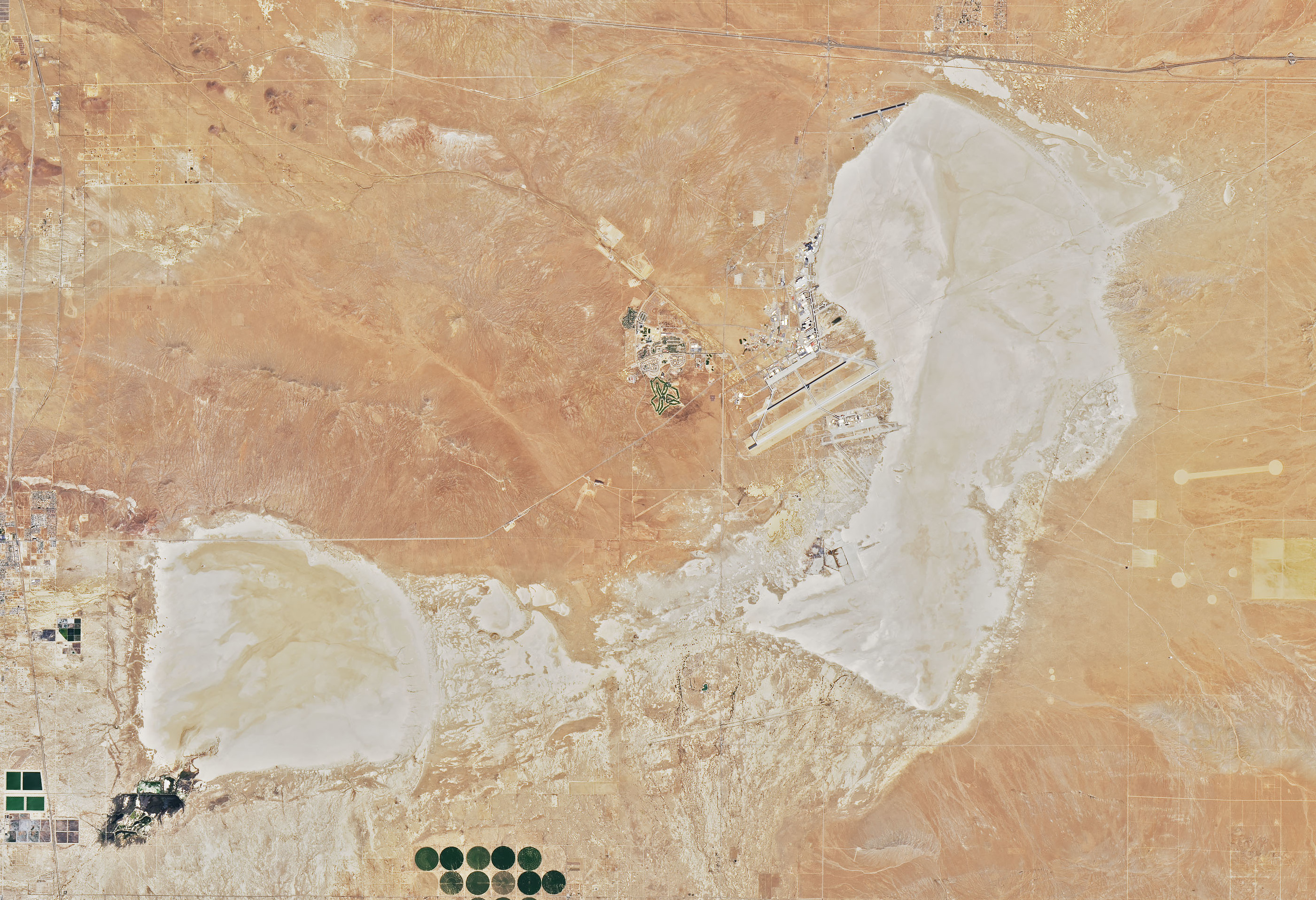
Description: Satellite image of the Rogers Dry Lake (on the right side) and the smaller Rosamond Lake (bottom left). Well visible: Edwards Air Force Base, located on the west side of Rogers Dry Lake. On July 1, 2019, Operational Land Imager (OLI) on NASA's Landsat 8 acquired this image.
Title: Rogers Dry Lake (California) – satellite image
Credit: https://earthobservatory.nasa.gov/images/145607/cameron-ridge?src=ve
Author: NASA
Usage Terms: Public domain
License: Public domain
Attribution Required?: No
Image usage
The following page links to this image:

All content from Kiddle encyclopedia articles (including the article images and facts) can be freely used under Attribution-ShareAlike license, unless stated otherwise.
_–_satellite_image.jpg)