
Image: Roman Africa

Size of this preview: 752 × 600 pixels. Other resolutions: 301 × 240 pixels | 3,057 × 2,439 pixels.
Original image (3,057 × 2,439 pixels, file size: 1.95 MB, MIME type: image/jpeg)
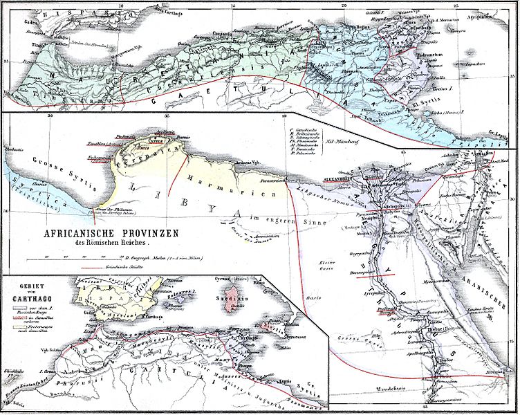
Description: The African provinces of the Roman Empire. The smaller map in the lower left shows the territory of the pre-Roman state of Carthage (blue), with yellow showing conquests and hashed red indicating territory lost to Rome in the First Punic War.
Title: Roman Africa
Credit: Historischer Schulatlas.
Author: H. Kiepert
Usage Terms: Public domain
License: Public domain
Attribution Required?: No
Image usage
The following page links to this image:

All content from Kiddle encyclopedia articles (including the article images and facts) can be freely used under Attribution-ShareAlike license, unless stated otherwise.