
Image: Roman Empires 476AD

Size of this PNG preview of this SVG file: 800 × 389 pixels. Other resolution: 320 × 156 pixels.
Original image (SVG file, nominally 1,753 × 853 pixels, file size: 147 KB)
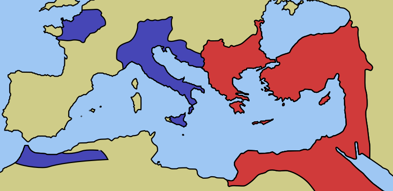
Description: A map of the territories controlled by Eastern and Western Roman Empires as of 476AD.
Title: Roman Empires 476AD
Credit: Own work
Author: Cthuljew
Usage Terms: Public domain
License: Public domain
Attribution Required?: No
Image usage
The following page links to this image:

All content from Kiddle encyclopedia articles (including the article images and facts) can be freely used under Attribution-ShareAlike license, unless stated otherwise.