
Image: Roman Italy

Size of this preview: 519 × 600 pixels. Other resolutions: 208 × 240 pixels | 846 × 978 pixels.
Original image (846 × 978 pixels, file size: 72 KB, MIME type: image/gif)
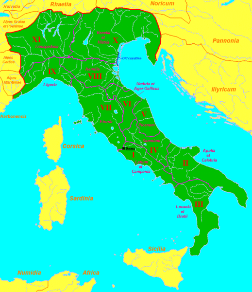
Description: Map of Roman Italy (green) and surrounding provinces (orange), showing its division in 11 regiones, with their names. Sources: partly based in maps of the University of Oregon [1], [2] and several maps and data of Wikipedia.
Title: Roman Italy
Credit: Transferred from en.wikipedia to Commons.
Author: Sugaar at English Wikipedia
Usage Terms: Public domain
License: Public domain
Attribution Required?: No
Image usage
The following 2 pages link to this image:

All content from Kiddle encyclopedia articles (including the article images and facts) can be freely used under Attribution-ShareAlike license, unless stated otherwise.