
Image: Route of the Expedition from Isle a la Crosse to Fort Providence in 1819 & 20 (1823)
Size of this preview: 800 × 434 pixels. Other resolutions: 320 × 174 pixels | 818 × 444 pixels.
Original image (818 × 444 pixels, file size: 177 KB, MIME type: image/jpeg)
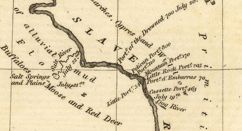
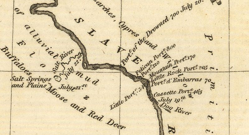
Description: A section of Franklin's map showing Salt River and parts of the Slave River, NWT
Title: Route of the Expedition from Isle a la Crosse to Fort Providence in 1819 & 20 (1823)
Credit: http://www.flickr.com/photos/manitobamaps/3751971809/
Author: Franklin, John. Route of the Expedition from Isle a la Crosse to Fort Providence in 1819 & 20 [map]. Scale not given. In: John Franklin. Narrative of a Journey to the Shores of the Polar Sea, in the Years 1819, 20, 21, and 22. London: John Murray, 1823.
Usage Terms: Public domain
License: Public domain
Attribution Required?: No
Image usage
The following 2 pages link to this image:

All content from Kiddle encyclopedia articles (including the article images and facts) can be freely used under Attribution-ShareAlike license, unless stated otherwise.
.jpg)