
Image: Roxburgh NSW county map 1872

Size of this preview: 800 × 578 pixels. Other resolutions: 320 × 231 pixels | 5,000 × 3,613 pixels.
Original image (5,000 × 3,613 pixels, file size: 9.11 MB, MIME type: image/jpeg)
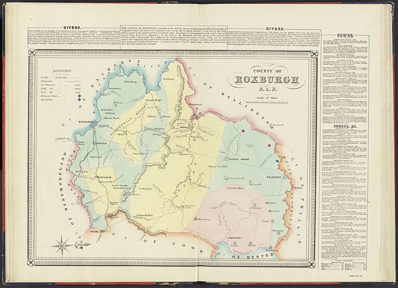
Description: Roxburg county, map of 1872
Title: Roxburgh NSW county map 1872
Credit: https://nla.gov.au/nla.obj-231005543/view
Author: George Bishop, Surveyor-General's Office
Usage Terms: Public domain
License: Public domain
Attribution Required?: No
Image usage
The following page links to this image:

All content from Kiddle encyclopedia articles (including the article images and facts) can be freely used under Attribution-ShareAlike license, unless stated otherwise.