
Image: RwandaGeoProvinces
No higher resolution available.
RwandaGeoProvinces.png (327 × 317 pixels, file size: 23 KB, MIME type: image/png)
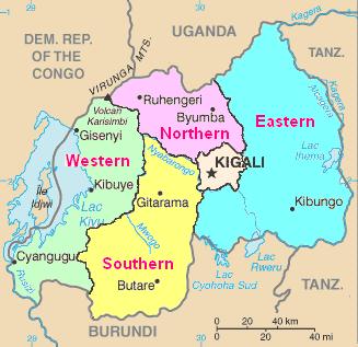
Description: Map of Rwanda from CIA World Factbook, with province boundaries and names added.
Title: RwandaGeoProvinces
Credit: Rw-map.png
Author: File:Rw-map.png: CIA derivative work: Amakuru (talk)
Usage Terms: Public domain
License: Public domain
Attribution Required?: No
Image usage
The following page links to this image:

All content from Kiddle encyclopedia articles (including the article images and facts) can be freely used under Attribution-ShareAlike license, unless stated otherwise.