
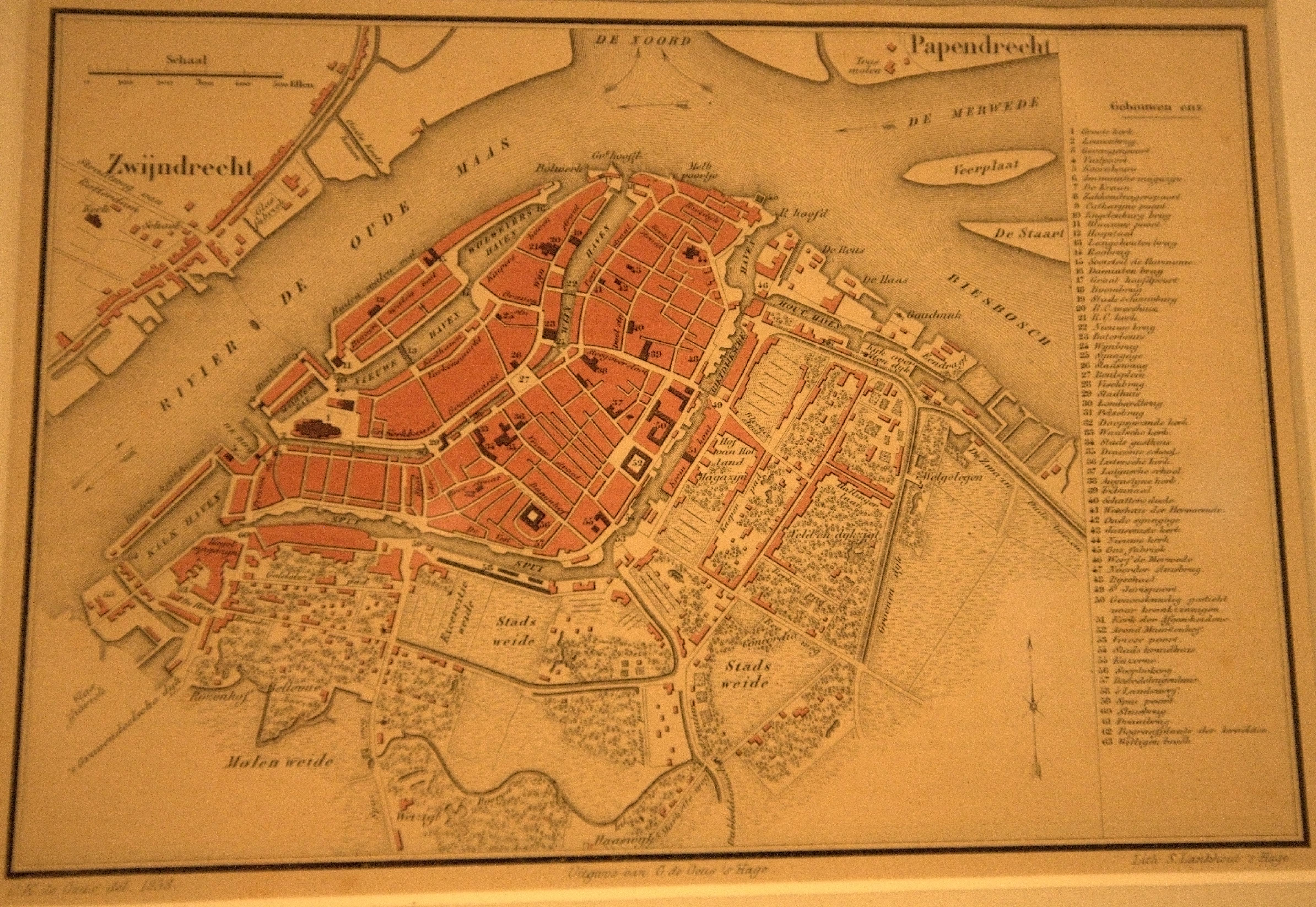
Image: S. Lankhout 1858 Map of Dordrecht
Description: Photograph taken in the Dordrecht Museum. Not super clear due to poor lighting conditions and the lack of a tripod, but better than any other available published form of the map, including the exhibition's own books. The physical map is very small, only 19x13cm. This map is notable for its depiction of two Synagogues, a feature not apparent on many other historic maps of Dordrecht. Other sources such as http://www.jhm.nl/culture-and-history/the-netherlands/zuid-holland/dordrecht suggest there was fragmentation within the local Jewish community which may have contributed to the requirement for multiple places of worship. The main Synagogue was apparently stripped and demolished. It was located at the northern edge of a square now known as Grote Markt, on the Varkemarkt street corner. The so-called Grote Markt appears to date from the 20th century, not being shown on earlier maps. Probably the Jewish area was demolished by the Nazis and replaced with this ugly square, which remains completely out of character with the surrounding buildings even today.
Title: S. Lankhout 1858 Map of Dordrecht
Credit: Own work
Author: Pratyeka
Usage Terms: Creative Commons Attribution-Share Alike 3.0
License: CC BY-SA 3.0
License Link: http://creativecommons.org/licenses/by-sa/3.0
Attribution Required?: Yes
Image usage
The following page links to this image:
