
Image: SE-USshoreline

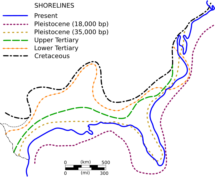
Description: Important shoreline positions along the Gulf and Atlantic Coasts since the Cretaceous Periods. This is an SVG version copied from the bitmap source. From the source: "Much of the coastal plain is comprised of both marine strata (those deposited under water) and continental strata (those deposited on dry land). This indicates that sea level rose and fell many times over the past 100 million years. The modern coast was shaped primarily by sea level changes that have taken place over the past 2 million years as the result of the development and demise of huge ice sheets that covered much of the world's high latitudes. Although these vertical sea level changes had a maximum range of more than 100 meters, the shoreline migrated horizontally up to 200 kilometers in some places. In doing so, important sedimentary deposits accumulated along the shorelines. Along the Atlantic and Gulf Coasts, many were in the form of barrier islands."
Title: SE-USshoreline
Credit: http://www.csc.noaa.gov/beachnourishment/html/geo/
Author: NOAA Coastal Services Center
Usage Terms: Public domain
License: Public domain
Attribution Required?: No
Image usage
The following page links to this image:
