
Image: Sakurajima 1902 survey

Size of this preview: 774 × 599 pixels. Other resolutions: 310 × 240 pixels | 1,170 × 906 pixels.
Original image (1,170 × 906 pixels, file size: 243 KB, MIME type: image/jpeg)
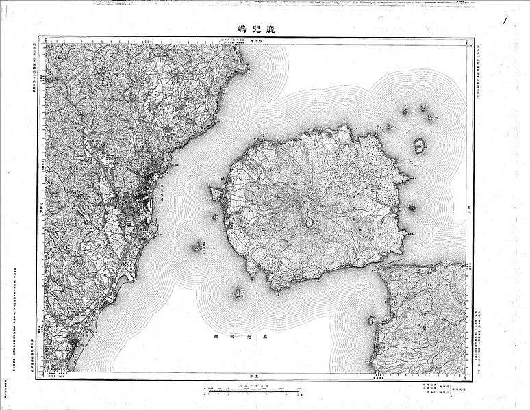
Description: A 1909 map of Sakurajima by the Imperial Japanese Land Survey, based on survey data taken in 1902. The map shows Sakurajima as an island, before a land bridge connected it to Ōsumi Peninsula after the 1914 eruption.
Title: Sakurajima 1902 survey
Credit: http://mapps.gsi.go.jp/contentsImageDisplay.do?specificationId=1373976&isDetail=false
Author: Imperial Japanese Land Survey, Ministry of Land, Infrastructure and Transport (Japan), Aerial map web page
License: Attribution
Image usage
The following page links to this image:

All content from Kiddle encyclopedia articles (including the article images and facts) can be freely used under Attribution-ShareAlike license, unless stated otherwise.