
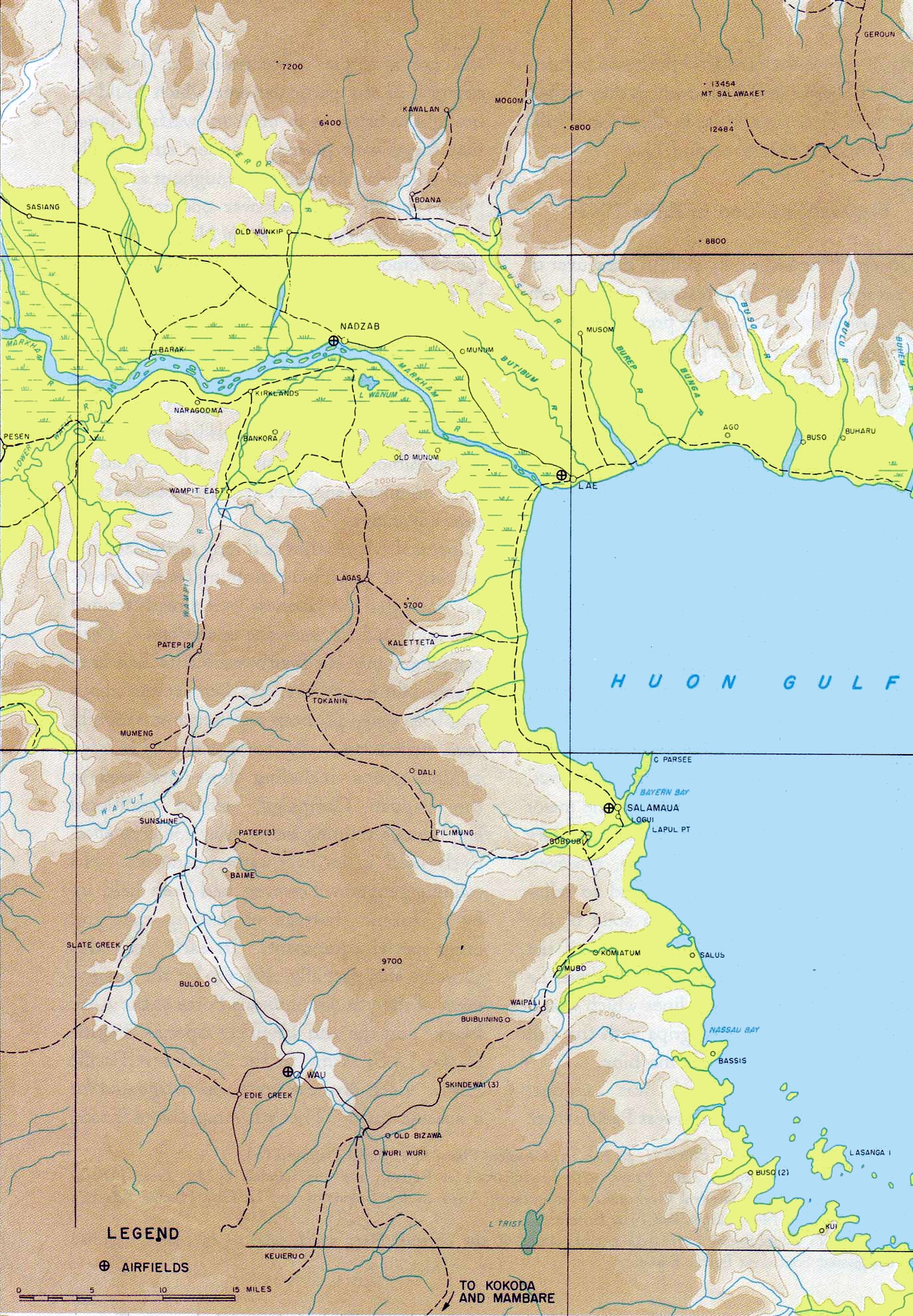
Image: Salamaua-Lae
Size of this preview: 416 × 600 pixels. Other resolutions: 166 × 240 pixels | 1,376 × 1,984 pixels.
Original image (1,376 × 1,984 pixels, file size: 631 KB, MIME type: image/jpeg)
Description: A U.S. military map of the area surrounding the towns of Salamaua And Lae, New Guinea
Title: Salamaua-Lae
Credit: Reports of General MacArthur - The Campaigns Of Macarthur In The Pacific Volume I, U.S. Army Center of Military History
Author: U.S. Army Center of Military History
Usage Terms: Public domain
License: Public domain
Attribution Required?: No
Image usage
The following 2 pages link to this image:

All content from Kiddle encyclopedia articles (including the article images and facts) can be freely used under Attribution-ShareAlike license, unless stated otherwise.