
Image: Sandy Radar 20121029 1818 UTC
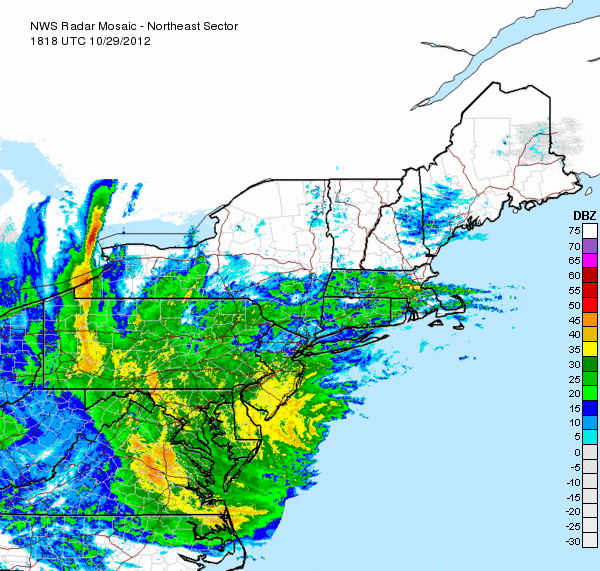
Description: Cloud cover associated with hurricane Sandy spread into the region as early as October 27, while Sandy was still off the Florida coast. As Sandy continued to slowly approach the region, winds began to steadily increase on the 28th, with coastal flooding reported in parts of the Mid Atlantic regions over a day before landfall. The NYC area stayed mostly dry during this time period through early on the 29th other than scattered showers at times; meanwhile, heavy rain was already affecting southeastern parts of the region, especially in the Delmarva Peninsula, on the 28th, intensifying and spreading into Virginia and Washington DC by the morning of the 29th.
Title: Sandy Radar 20121029 1818 UTC
Credit: http://www.nycareaweather.com/2012/10/hurricane-sandy-summary/
Author: NWS
Usage Terms: Public domain
License: Public domain
Attribution Required?: No
Image usage
The following page links to this image:
