
Image: Scottish Borders UK location map

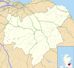
Description: Blank map of the Scottish Borders, UK with the following information shown: Administrative borders Coastline, lakes and rivers Roads and railways Urban areas Equirectangular map projection on WGS 84 datum, with N/S stretched 170% Geographic limits: West: 3.60W East: 1.95W North: 56.00N South: 55.10N
Title: Scottish Borders UK location map
Credit: Ordnance Survey OpenData. Administrative borders and coastline data from Boundary-Line product. All other geographic data from Meridian 2 product. Inset derived from Inset derived from File:Scotland location map.svg by NordNordWest.
Author: Nilfanion, created using Ordnance Survey data
Permission: This file is licensed under the Creative Commons Attribution-Share Alike 3.0 Unported license. Attribution: Contains Ordnance Survey data © Crown copyright and database right You are free: to share – to copy, distribute and transmit the work to remix – to adapt the work Under the following conditions: attribution – You must give appropriate credit, provide a link to the license, and indicate if changes were made. You may do so in any reasonable manner, but not in any way that suggests the licensor endorses you or your use. share alike – If you remix, transform, or build upon the material, you must distribute your contributions under the same or compatible license as the original. https://creativecommons.org/licenses/by-sa/3.0 CC BY-SA 3.0 Creative Commons Attribution-Share Alike 3.0 truetrue
Usage Terms: Creative Commons Attribution-Share Alike 3.0
License: CC BY-SA 3.0
License Link: https://creativecommons.org/licenses/by-sa/3.0
Attribution Required?: Yes
Image usage
The following 51 pages link to this image:
- Abbey St Bathans
- Allanton, Scottish Borders
- Ayton, Scottish Borders
- Ayton Castle, Scottish Borders
- Bite-about Pele
- Black Meldon
- Bonkyll Castle
- Bow Castle Broch
- Burnmouth
- Chirnside
- Cockburnspath
- Coldingham
- Coldstream
- Duns, Scottish Borders
- Earlston
- Edin's Hall Broch
- Edrom
- Eildon Hill
- Ettrick, Scotland
- Eyemouth
- Fast Castle
- Foulden, Scottish Borders
- Galashiels
- Greenlaw
- Hume, Scottish Borders
- Hume Castle
- Hutton, Scottish Borders
- Jedburgh
- Kelso, Scottish Borders
- Lamberton, Scottish Borders
- Lauder
- Longformacus
- Melrose, Scottish Borders
- Milkieston Rings
- Neidpath Castle
- Ninestane Rig
- Northshield Rings
- Oxnam
- Oxton, Scottish Borders
- Paxton, Scottish Borders
- Peebles
- Pennymuir Roman camps
- Roxburgh
- Selkirk, Scottish Borders
- St Abb's Head
- St Boswells
- Stow of Wedale
- Torwoodlee Broch
- Trimontium (Newstead)
- Upper Tweeddale National Scenic Area
- White Meldon
