
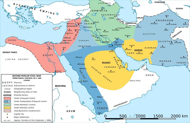
Image: Second Fitna Territorial Control Map ca 686

Size of this PNG preview of this SVG file: 800 × 521 pixels. Other resolution: 320 × 209 pixels.
Original image (SVG file, nominally 1,880 × 1,225 pixels, file size: 1.67 MB)
Description: SVG version of File:Second Fitna Territorial Control Map ca 686.png by Al Ameer son. For description and sources, cf. there.
Title: Second Fitna Territorial Control Map ca 686
Credit: Own work
Author: original map by Al Ameer son; SVG version by Konstantinos Plakidas
Usage Terms: Creative Commons Attribution-Share Alike 4.0
License: CC BY-SA 4.0
License Link: https://creativecommons.org/licenses/by-sa/4.0
Attribution Required?: Yes
Image usage
The following 2 pages link to this image:

All content from Kiddle encyclopedia articles (including the article images and facts) can be freely used under Attribution-ShareAlike license, unless stated otherwise.