
Image: Seljuk Empire locator map

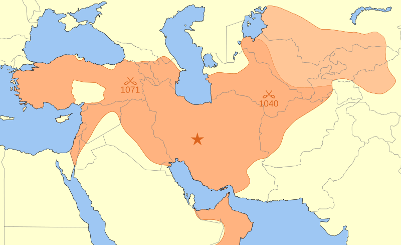
Description: A map showing the Great Seljuk Empire at its height, upon the death of Malik Shah I in 1092. The capital of the Great Seljuk Empire is shown at Ishfahan (Persia/Iran). The borders of present-day countries are shown in gray. The lighter colour in the top right represents Karakhanids. "In 1089, Malik Shah returned to the charge, occupied Bukhara, captured Sarakand, and imprisoned the Karakhanid Ahmed . . . whom he later reinstated as client-ruler. From that time forward, the Karakhanids who reigned in Bukhara and Samarkand did so as lieutenants of the Seljuk sultans. Transoxiana was now no more than a dependency of the Seljuk Empire." (Grousset p. 147.) Other areas such as the Danishmends are not shown separately. The locations of the Battle of Manzikert (1071) and the Battle of Dandanaqan (1040) are also shown.
Title: Seljuk Empire locator map
Credit: Own work
Author: MapMaster
Usage Terms: GNU Free Documentation License
License: GFDL
License Link: http://www.gnu.org/copyleft/fdl.html
Attribution Required?: Yes
Image usage
The following 3 pages link to this image:
