
Image: Severe plot for 7-10-1989

Size of this preview: 681 × 599 pixels. Other resolutions: 273 × 240 pixels | 718 × 632 pixels.
Original image (718 × 632 pixels, file size: 17 KB, MIME type: image/png)
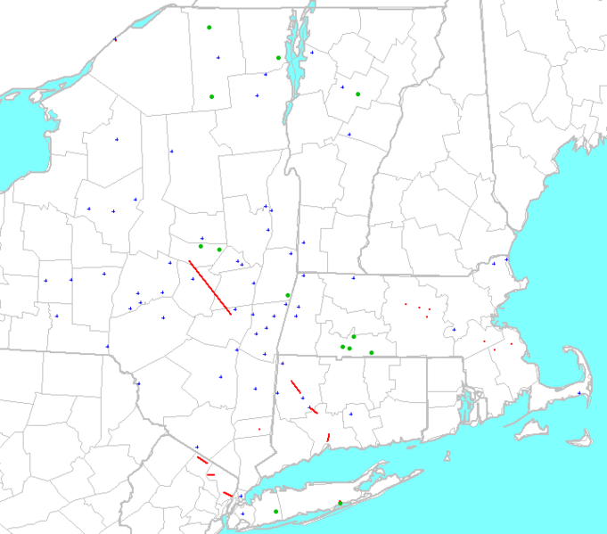
Description: From "Severe Plot", a program created by an SPC employee, for free use. This is a map of the Northeastern United States with storm reports from July 10, 1989 shown. The red lines are tornado paths, the blue crosses are reports of wind damage or strong winds (>60 mph, 95 km/h), and the green dots are reports of hail 0.75 inches (20 mm) across or larger.
Title: Severe plot for 7-10-1989
Credit: Transferred from en.wikipedia by SreeBot
Author: Runningonbrains at en.wikipedia
Usage Terms: Public domain
License: Public domain
Attribution Required?: No
Image usage
The following page links to this image:

All content from Kiddle encyclopedia articles (including the article images and facts) can be freely used under Attribution-ShareAlike license, unless stated otherwise.