
Image: Sevierrivermap
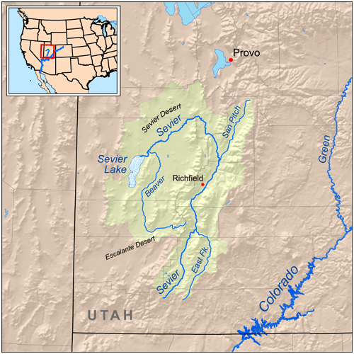
Description: Map showing the Sevier Lake/Sevier River drainage basin. South of Great Salt Lake: west-to-east en:Cedar Mountains (Tooele County), en:Skull Valley (Utah), en:Stansbury Mountains, en:Tooele Valley, en:Oquirrh Mountains Mountain ranges around Utah Lake: en:Lake Mountains-(west border), en:Traverse Range-north, en:Wasatch Range, NE,E, & SE, en:East Tintic Mountains-south-southwest North of Sevier drainage:en:Sheeprock Mountains-(attached north), en:Onaqui Mountains, northwest
Title: Sevierrivermap
Credit: Self-made, based on USGS data.
Author: Kmusser
Usage Terms: Creative Commons Attribution-Share Alike 3.0
License: CC BY-SA 3.0
License Link: https://creativecommons.org/licenses/by-sa/3.0
Attribution Required?: Yes
Image usage
The following 8 pages link to this image:
