
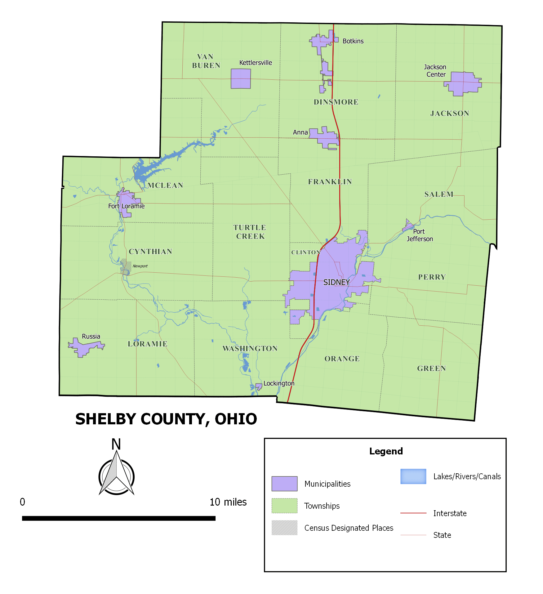
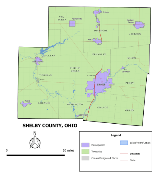
Image: ShelbyCountyOH2017
Size of this preview: 548 × 599 pixels. Other resolutions: 219 × 240 pixels | 1,751 × 1,915 pixels.
Original image (1,751 × 1,915 pixels, file size: 188 KB, MIME type: image/png)
Description: Map of Shelby County, Ohio created with 2015 U.S. Census Bureau TIGER files (with modifications and updates) on QGIS software.
Title: ShelbyCountyOH2017
Credit: Map of Shelby County, Ohio created with 2015 U.S. Census Bureau TIGER files (with modifications and updates) on QGIS software.
Author: Wdcrawford
Usage Terms: Creative Commons Attribution-ShareAlike 4.0
License: CC-BY-SA-4.0
License Link: https://creativecommons.org/licenses/by-sa/4.0/
Attribution Required?: Yes
Image usage
The following page links to this image:

All content from Kiddle encyclopedia articles (including the article images and facts) can be freely used under Attribution-ShareAlike license, unless stated otherwise.