
Image: Shires of Scotland by population (2011)

Size of this preview: 460 × 600 pixels. Other resolutions: 184 × 240 pixels | 940 × 1,226 pixels.
Original image (940 × 1,226 pixels, file size: 105 KB, MIME type: image/png)
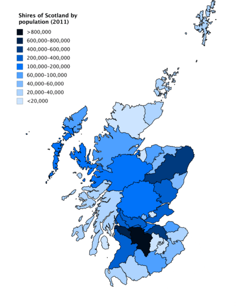
Description: A choropleth map showing population of the historic Shires of Scotland in 2011, based on data from Scotland's Census. Values were calculated by adding the population of all the civil parishes in each shire. Some parishes do not have data in the Census (1 in Fife, 2 in Forfarshire, 1 in Lanarkshire, 2 in Peeblesshire and 2 in Perthshire), and these parishes are not counted in the population of the shires.
Title: Shires of Scotland by population (2011)
Credit: Own work
Author: JackintheBox
Usage Terms: Creative Commons Attribution-Share Alike 4.0
License: CC BY-SA 4.0
License Link: https://creativecommons.org/licenses/by-sa/4.0
Attribution Required?: Yes
Image usage
The following page links to this image:

All content from Kiddle encyclopedia articles (including the article images and facts) can be freely used under Attribution-ShareAlike license, unless stated otherwise.
.png)