
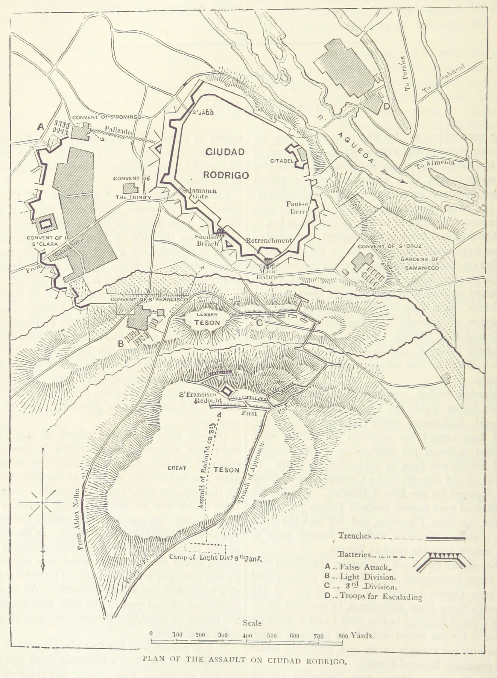
Image: Siege of Ciudad Rodrigo (1812) map
Size of this preview: 439 × 599 pixels. Other resolutions: 176 × 240 pixels | 1,661 × 2,266 pixels.
Original image (1,661 × 2,266 pixels, file size: 596 KB, MIME type: image/jpeg)
Description: A map of the 1812 Siege of Ciudad Rodrigo, where English forces assaulted the French-held fortress.
Title: Siege of Ciudad Rodrigo (1812) map
Credit: This file is from the Mechanical Curator collection, a set of over 1 million images scanned from out-of-copyright books and released to Flickr Commons by the British Library. View image on Flickr View all images from book View catalogue entry for book.
Author: James Grant
Usage Terms: Public domain
License: Public domain
Attribution Required?: No
Image usage
The following page links to this image:

All content from Kiddle encyclopedia articles (including the article images and facts) can be freely used under Attribution-ShareAlike license, unless stated otherwise.
_map.jpg)