
Image: Simplified geologic map of the Barberton greenstone belt.pdf
Size of this JPG preview of this PDF file: 799 × 599 pixels. Other resolution: 320 × 240 pixels.
Original image (1,666 × 1,250 pixels, file size: 224 KB, MIME type: application/pdf)
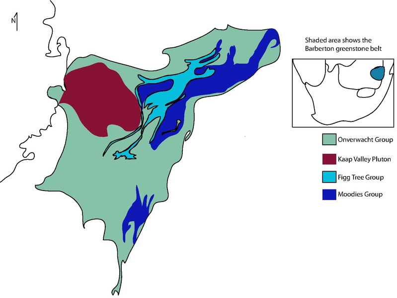
Description: This is a simplified geologic map of the Barberton Greenstone belt, South Africa, showing three of the major Groups and their interactions as well as the Kaap Valley Craton.
Author: Morabiac
Usage Terms: Creative Commons Attribution-Share Alike 3.0
License: CC-BY-SA-3.0
License Link: http://creativecommons.org/licenses/by-sa/3.0/
Attribution Required?: Yes
Image usage
The following page links to this image:

All content from Kiddle encyclopedia articles (including the article images and facts) can be freely used under Attribution-ShareAlike license, unless stated otherwise.