
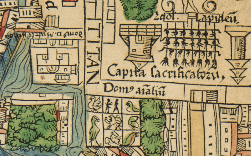
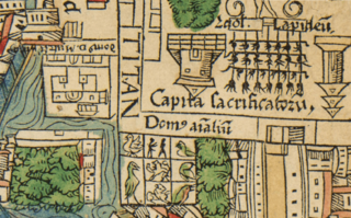
Image: Sitio del Totocalli y el palacio de Moctezuma II en el mapa te Tenochtitlán de Hernán Cortés (1524)

Description: Detail of the map of the city of Mexico-Tenochtitlan from a 1524 edition of the second letter to the king of Spain Carlos I sent by the Spanish captain Hernán Cortés, which was likely based on an original map sent by him along with the letter in 30 October 1520. In this map, the north is pointing at the right. The detail shows the location of the palace of emperor Moctezuma II of Mexico (labeled Domus Don Muteczuma) at the left, which was south of the central plaza of the city, and the Totocalli (labeled Domus Animalum), the zoo built as part of the palace complex, also next to the central plaza.
Title: Sitio del Totocalli y el palacio de Moctezuma II en el mapa te Tenochtitlán de Hernán Cortés (1524)
Credit: World Digital Library: https://www.loc.gov/resource/gdcwdl.wdl_19994/?sp=14
Author: Seemingly based on an original map by Hernán Cortés.
Usage Terms: Public domain
License: Public domain
Attribution Required?: No
Image usage
The following page links to this image:

.png)