
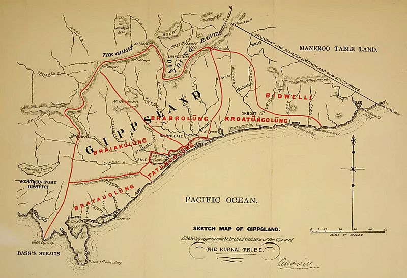
Image: Sketch Map of Gippsland - Showing approximately the Positions of the Clans of the Kurnai Tribe

Size of this preview: 800 × 548 pixels. Other resolutions: 320 × 219 pixels | 3,818 × 2,614 pixels.
Original image (3,818 × 2,614 pixels, file size: 1.03 MB, MIME type: image/jpeg)
Description: Sketch Map of Gippsland - Showing approximately the Positions of the Clans of the Kurnai Tribe.jpg
Title: Sketch Map of Gippsland - Showing approximately the Positions of the Clans of the Kurnai Tribe
Credit: File:Kamilaroi and Kurnai.djvu p. 8
Author: Fison, Lorimer, 1832-1907; Howitt, A. W. (Alfred William), 1830-1908
Usage Terms: Public domain
License: Public domain
Attribution Required?: No
Image usage
The following page links to this image:

All content from Kiddle encyclopedia articles (including the article images and facts) can be freely used under Attribution-ShareAlike license, unless stated otherwise.