
Image: SomersetHills-aerial
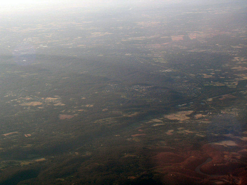
Description: Aerial photo of part of the Somerset Hills region, looking south. Geographical Index, from roughly left to right, near to far: Liberty Corner (fields left-center), Interstate 78 (narrow horizontal grove), The Hills in Bernards Twp and Bedminster, Interstate 287 (broad and curving), Far Hills, Bedminster, North Branch Raritan River (vertical grove), and hills (with Ravine Lake visible) between Bernardsville and Peapack-Gladstone; First and Second Watchung Mountains (parallel ridges) have Washington Valley Road running parallel between them (not visible), the gap at left marks the location of a quarry, Chimney Rock Road, Washington Valley Park, and a resevoir, while the smaller gaps near The Hills (center of photo) mark a gas pipeline; to the south lie Bridgewater Township, Somerville, Raritan, Manville, and other settlements of the Raritan River Valley. Observed on a westbound flight originating in Newark Liberty Intl. The image spans approx. 3 miles horizontally at bottom edge and approx. 5 miles across center.
Title: SomersetHills-aerial
Credit: Own work
Author: JChernJ
Usage Terms: Creative Commons Attribution-Share Alike 3.0
License: CC BY-SA 3.0
License Link: http://creativecommons.org/licenses/by-sa/3.0
Attribution Required?: Yes
Image usage
The following page links to this image:
