
Image: Soufriere Hills Volcano dome collapse
Size of this preview: 600 × 600 pixels. Other resolutions: 240 × 240 pixels | 1,791 × 1,791 pixels.
Original image (1,791 × 1,791 pixels, file size: 1.27 MB, MIME type: image/gif, looped, 2 frames, 4.0 s)
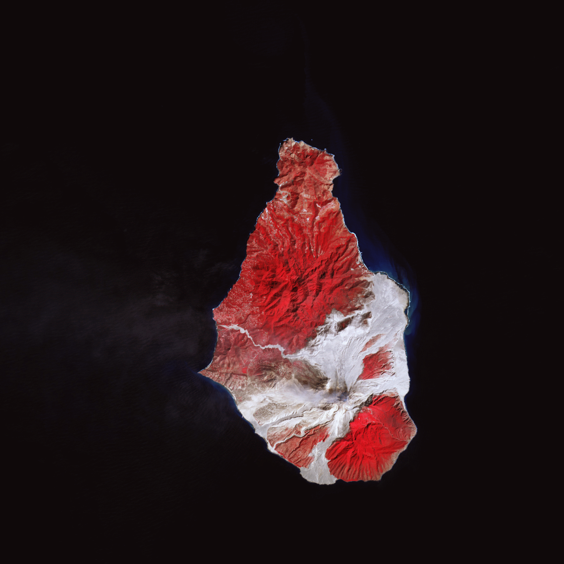
Description: These false-colour satellite images show the southern half of Montserrat before and after its dome collapsed. Red areas are vegetated, clouds are white, blue/black areas are ocean water, and grey areas are covered by flow deposits. Fresh deposits tend to be lighter than older deposits. the drainages leading down from Soufrière Hills, including the White River Valley, the Tar River Valley, and the Belham River Valley, were filled with fresh debris.
Title: Soufriere Hills Volcano dome collapse
Credit: NASA Earth Observatory
Author: Robert Simmon
Usage Terms: Public domain
License: Public domain
Attribution Required?: No
Image usage
The following 2 pages link to this image:

All content from Kiddle encyclopedia articles (including the article images and facts) can be freely used under Attribution-ShareAlike license, unless stated otherwise.