
Image: SouthIndia1794

Size of this preview: 800 × 409 pixels. Other resolutions: 320 × 164 pixels | 814 × 416 pixels.
Original image (814 × 416 pixels, file size: 110 KB, MIME type: image/jpeg)
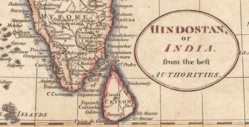
Description: This is a detail from a period map showing the major coastal colonial outposts in southern India and Ceylon in 1794. Control of many of these outposts changed hands during the 18th century; which state (usually France, the Dutch Republic, or the United Kingdom) controls which locations is not shown.
Title: SouthIndia1794
Credit: http://alabamamaps.ua.edu/historicalmaps/asia/southasia.html
Author: Unknown authorUnknown author
Usage Terms: Public domain
License: Public domain
Attribution Required?: No
Image usage
The following 2 pages link to this image:

All content from Kiddle encyclopedia articles (including the article images and facts) can be freely used under Attribution-ShareAlike license, unless stated otherwise.