
Image: South Geelong
No higher resolution available.
South_Geelong.jpg (364 × 341 pixels, file size: 43 KB, MIME type: image/jpeg)
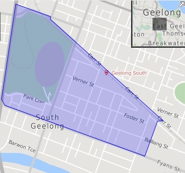
Description: This is an automatically generated map by the Australian Bureau of Statistics for the 2011 census. It shows the boundary lines for the suburb of South Geelong as defined in the census.
Title: South Geelong
Credit: Own work
Author: Kualityedits
Usage Terms: Creative Commons Attribution-Share Alike 4.0
License: CC BY-SA 4.0
License Link: http://creativecommons.org/licenses/by-sa/4.0
Attribution Required?: Yes
Image usage
There are no pages that link to this image.

All content from Kiddle encyclopedia articles (including the article images and facts) can be freely used under Attribution-ShareAlike license, unless stated otherwise.