
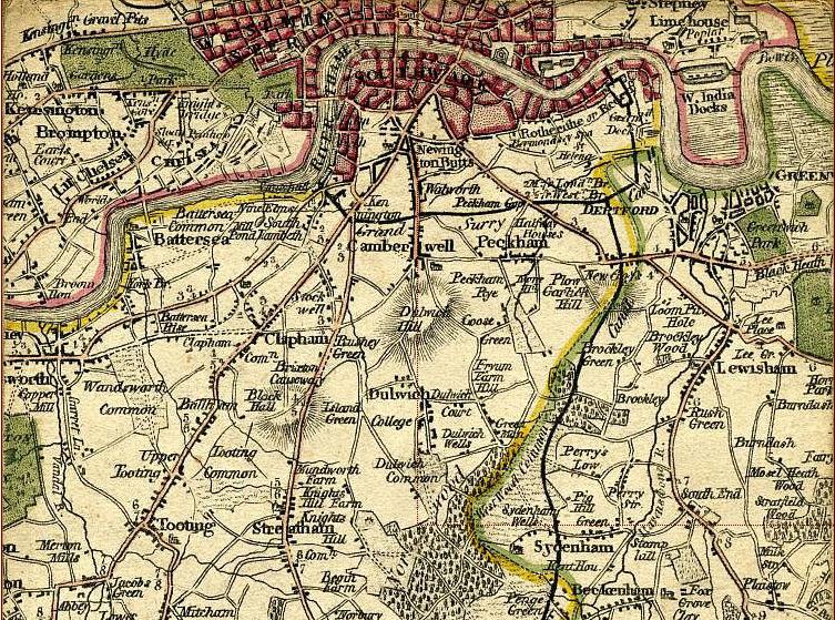
Image: South London Map 1800
No higher resolution available.
South_London_Map_1800.jpg (753 × 559 pixels, file size: 205 KB, MIME type: image/jpeg)
Description: 1800 Map showing what is now South London, including Kennington, Camberwell, Peckham, Clapham, Brixton, Stockwell, Streatham Hill, Tooting, Dulwich, Brockley, Lewisham and Deptford
Title: South London Map 1800
Credit: http://archivemaps.com/mapco/faden/faden13.htm
Author: Topographical Map Of The Country Twenty Miles Round London 1800
Usage Terms: Public domain in the United States
License: PD-US
License Link: //en.wikipedia.org/wiki/File:South_London_Map_1800.jpg
Image usage
The following 3 pages link to this image:

All content from Kiddle encyclopedia articles (including the article images and facts) can be freely used under Attribution-ShareAlike license, unless stated otherwise.