
Image: Southeast Europe 1812 map en

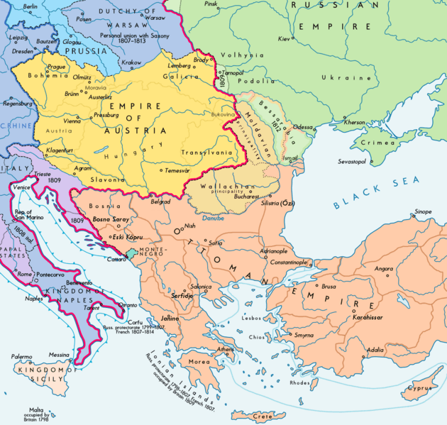
Description: Southeast Europe in 1812 (before Napoleon's Russian Campaign ; according with H.E.Stier (dir.) Grosser Atlas zur Weltgeschichte, Westermann 1984, p.119, ISBN 3141009198, & all sources, the Danubian principalities were not turkish provinces but vassal christian states (ruled by Greek hospodars), and the russian Bessarabia were, before 1812, a part of the Moldavian principality (north side) and of the Ottoman empire (south side) : see little changes 02-05-2014)
Title: Southeast Europe 1812 map en
Credit: Wikimedia Commons
Author: Europe 1812 map en.png: Alexander Altenhof (KaterBegemot) Derivative work: Durero (talk)
Permission: This file has been extracted from another file
Usage Terms: Creative Commons Attribution-Share Alike 3.0
License: CC BY-SA 3.0
License Link: https://creativecommons.org/licenses/by-sa/3.0
Attribution Required?: Yes
Image usage
The following 2 pages link to this image:
