
Image: Southern United States Civil War map
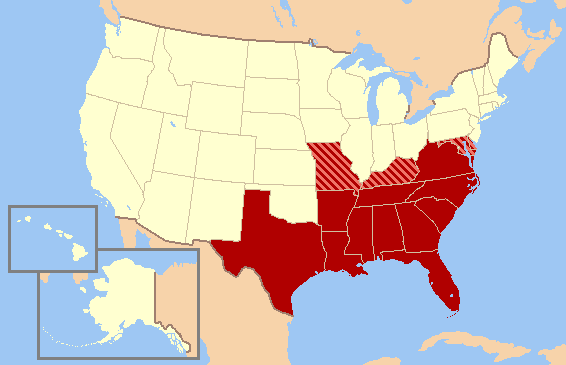
Description: Historic map of Southern United States, based on Civil War allegiances. The states in solid red seceded from the Union to form the Confederate States of America, while the striped states - Missouri, Kentucky, Maryland, and Delaware - were "Border States" that remained in the Union at gunpoint and fought with both the Confederate and Union. Oklahoma (not yet a state) was then Indian Territory. The Northern Counties of Virginia chose to remain in the Union and in 1863 became the state of West Virginia.
Title: Southern United States Civil War map
Credit: Own work
Author: Gator87
Usage Terms: Creative Commons Attribution-Share Alike 3.0
License: CC-BY-SA-3.0
License Link: http://creativecommons.org/licenses/by-sa/3.0/
Attribution Required?: Yes
Image usage
The following page links to this image:
