
Image: Southwesttrailmap
No higher resolution available.
Southwesttrailmap.png (500 × 500 pixels, file size: 119 KB, MIME type: image/png)
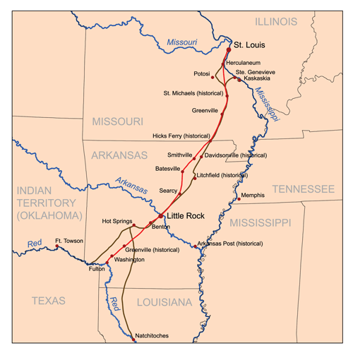
Description: This is a map I made of the Southwest Trail through Missouri and Arkansas. The Southwest Trail or Military Road as it was in the mid-1800's is in red. The Natchitoches Trace that it replaced is in brown. Map is based heavily on maps available at http://www.southwesttrail.com/.
Title: Southwesttrailmap
Credit: No machine-readable source provided. Own work assumed (based on copyright claims).
Author: No machine-readable author provided. Kmusser assumed (based on copyright claims).
Usage Terms: Creative Commons Attribution-Share Alike 2.5
License: CC BY-SA 2.5
License Link: https://creativecommons.org/licenses/by-sa/2.5
Attribution Required?: Yes
Image usage
The following 2 pages link to this image:

All content from Kiddle encyclopedia articles (including the article images and facts) can be freely used under Attribution-ShareAlike license, unless stated otherwise.