
Image: Spanish Empire Anachronous en

Size of this PNG preview of this SVG file: 800 × 407 pixels. Other resolution: 320 × 163 pixels.
Original image (SVG file, nominally 2,753 × 1,399 pixels, file size: 1.01 MB)
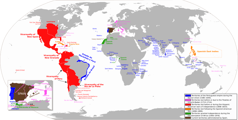
Description: Anachronous map of the Spanish Empire
Territories of the Portuguese empire during the Iberian Union (1580-1640)
Territories until the Treaties of Utrecht-Baden (1713–1714)
Territories until the Spanish American wars of independence (1808–1833)
Territories until the Spanish-American War (1898-1899)
Territories granted independence during the Decolonization of Africa (1956-1976)
Current territories administered by Spain
Author: Trasamundo
Usage Terms: Creative Commons Attribution-Share Alike 3.0
License: CC-BY-SA-3.0
License Link: http://creativecommons.org/licenses/by-sa/3.0/
Attribution Required?: Yes
Image usage
The following 3 pages link to this image:

All content from Kiddle encyclopedia articles (including the article images and facts) can be freely used under Attribution-ShareAlike license, unless stated otherwise.