
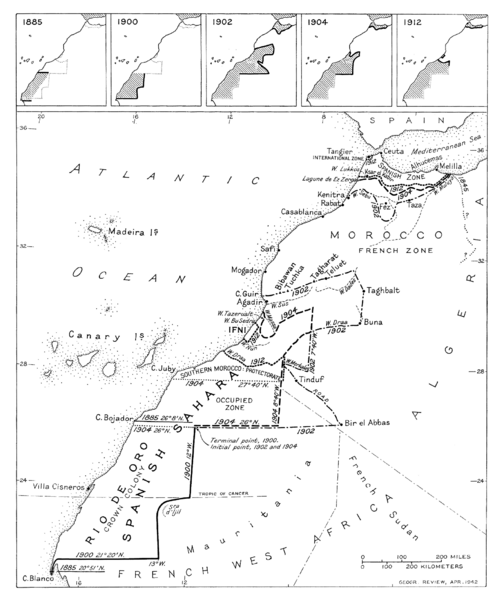
Image: Spanish territorial boundary changes in Northwest Africa 1885-1912

Size of this preview: 495 × 600 pixels. Other resolutions: 198 × 240 pixels | 1,724 × 2,089 pixels.
Original image (1,724 × 2,089 pixels, file size: 142 KB, MIME type: image/png)
Description: Map showing Spanish territorial expansion and contraction in Morocco and the Western Sahara from the late 19th century to the Franco-Spanish convention of 1912, which definitely settled the boundary issue and provided for the creation of the Spanish protectorate in Morocco.
Title: Spanish territorial boundary changes in Northwest Africa 1885-1912
Credit: Geographical Review (US)
Author: Geographical Review (US)
Usage Terms: Public domain
License: Public domain
Attribution Required?: No
Image usage
The following page links to this image:

All content from Kiddle encyclopedia articles (including the article images and facts) can be freely used under Attribution-ShareAlike license, unless stated otherwise.