
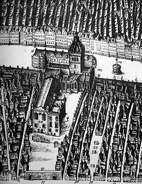
Image: St. Giles and Parliament House c.1647

Size of this preview: 464 × 600 pixels. Other resolutions: 186 × 240 pixels | 1,913 × 2,472 pixels.
Original image (1,913 × 2,472 pixels, file size: 1.73 MB, MIME type: image/jpeg)
Description: St. Giles Kirk and Parliament House from James Gordon of Rothiemay's map of Edinburgh 1647. The building beyond St. Giles is the row of open-fronted shops called the Luckenbooths. The town's tolbooth occupied the left end of the row.
Title: St. Giles and Parliament House c.1647
Credit: James Gordon of Rothiemay's map of Edinburgh 1647
Author: James Gordon of Rothiemay
Usage Terms: Public domain
License: Public domain
Attribution Required?: No
Image usage
The following 6 pages link to this image:

All content from Kiddle encyclopedia articles (including the article images and facts) can be freely used under Attribution-ShareAlike license, unless stated otherwise.