
Image: St Francis Dam area terrain relief 1

Size of this PNG preview of this SVG file: 800 × 406 pixels. Other resolution: 320 × 162 pixels.
Original image (SVG file, nominally 970 × 492 pixels, file size: 1.2 MB)
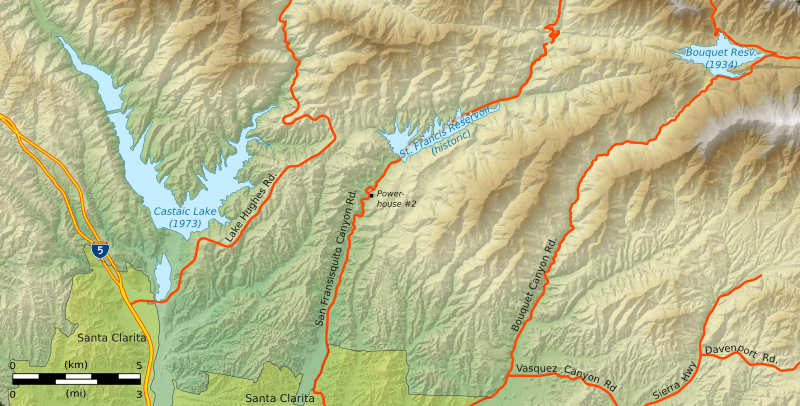
Description: Shaded relief terrain map of the area around the failed en:St. Francis Dam and reservoir, showing also the locations of two other large reservoirs constructed later. Roads and boundaries are shown in their current (2013) arrangement.
Title: St Francis Dam area terrain relief 1
Credit: Own work
Author: Kbh3rd
Usage Terms: Creative Commons Attribution 3.0
License: CC BY 3.0
License Link: https://creativecommons.org/licenses/by/3.0
Attribution Required?: Yes
Image usage
The following page links to this image:

All content from Kiddle encyclopedia articles (including the article images and facts) can be freely used under Attribution-ShareAlike license, unless stated otherwise.