
Image: St John's Lodge Regent's Park from 1833 Schmollinger map
No higher resolution available.
St_John's_Lodge_Regent's_Park_from_1833_Schmollinger_map.jpg (763 × 518 pixels, file size: 660 KB, MIME type: image/jpeg)
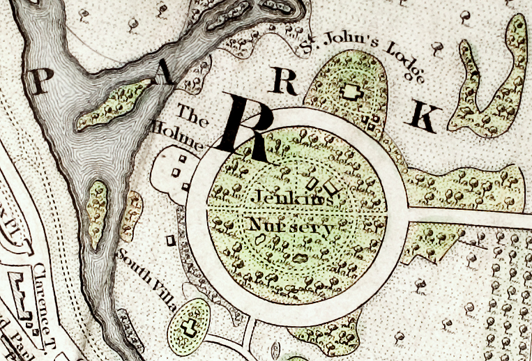
Description: 1833 map of the Inner Circle of Regents Park shows St. John's Lodge on the outside perimeter at about one o'clock and The Holme at about ten o'clock. The inside of the Inner Circle is labeled "Jenkins Nursery". Source: section of "Improved map of London for 1833, from Actual Survey. Engraved by W. Schmollinger, 27 Goswell Terrace", photographed for Wikipedia. All rights of the photographer in this image are hereby released.
Title: St John's Lodge Regent's Park from 1833 Schmollinger map
Credit: Transferred from en.wikipedia to Commons by Oxyman using CommonsHelper.
Author: Pointillist at English Wikipedia
Usage Terms: Public domain
License: Public domain
Attribution Required?: No
Image usage
The following page links to this image:

All content from Kiddle encyclopedia articles (including the article images and facts) can be freely used under Attribution-ShareAlike license, unless stated otherwise.