
Image: St Vith Map Ardennes

Size of this PNG preview of this SVG file: 800 × 509 pixels. Other resolution: 320 × 204 pixels.
Original image (SVG file, nominally 990 × 630 pixels, file size: 68 KB)
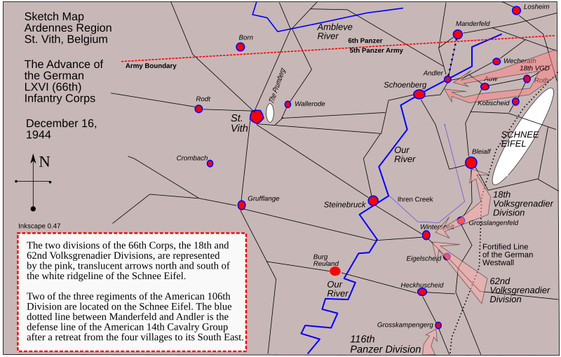
Description: This is a map of the Ardennes, Belgium, showing the advance of the German LXVI Corps on St. Vith, December 16, 1944. This is a sketch map, not to scale, but the furthest German advance covers about five miles. This map was drawn on Inkscape version 0.47.
Title: St Vith Map Ardennes
Credit: Own work
Author: Calendar5
Usage Terms: Creative Commons Attribution-Share Alike 3.0
License: CC BY-SA 3.0
License Link: https://creativecommons.org/licenses/by-sa/3.0
Attribution Required?: Yes
Image usage
The following page links to this image:

All content from Kiddle encyclopedia articles (including the article images and facts) can be freely used under Attribution-ShareAlike license, unless stated otherwise.